share


This piece was written in response To:


30km

by Simon Faithfull


This film was screened on White Screen in full throughout June 2015. A clip of the work is available to view on the FILM AND VIDEO UMBRELLA website here.


Courtesy the artist and Film and Video Umbrella

Armies Will Vanish

I don’t remember the first time I saw ‘Earthrise’, but I remember the moment I realised that it was wrong.


You know ‘Earthrise’. It’s the photograph of our planet as a perfect hemisphere, half in light and half in darkness, lifting itself above the lunar surface, which spreads out, grey and barren, in the foreground. It was taken on Christmas Eve 1968, and has featured on stamps and student posters the world over. Naïvely, from that foreground, I always assumed it was taken by an astronaut on the surface of the moon, feet planted in the lunar dust, looking up at the vault of heaven and his sapphire home.


‘Earthrise’ is a photograph taken by William Anders and it was taken not from the surface of the moon, but from orbit. Anders snapped it as Apollo 8 looped around the moon on the very first manned mission to leave earth orbit and it stands still as one of the most astonishing images produced by humankind, and a lasting totem of environmentalism.

But we don’t see it as Anders and Borman and Lovell saw it, because they were in a spacecraft coming around the moon and the surface was to the side, not below them. The image we know best has been rotated from the Lunar orbiter’s original perspective, and something about this deliberate editing has always stuck in my mind.


For the record, the ‘Blue Marble’ you know is a lie too. I mean, it’s not a lie. But it has been recomposed to better fit with our existing perceptions of the world, rather than accepting the radical post-Copernican possibilities that spaceflight might offer us. Blue Marble, the disseminated version of NASA Archive Photo AS17-148-22727, offers us the earth we expect to see, for the first time in full-face and fully illuminated. But Apollo 17’s trajectory on the morning of 7 December 1972 sent it up and out over southern Africa and Antarctica – and from that perspective, the perspective of the crew and the photographer, the South Pole is ‘up’: ‘Blue Marble’ is upside down.

Screen Shot 2015-06-10 at 16.19.44


(I still remember coming across a copy of – I think – McArthur’s Universal Corrective Map in the Tate, some time in the nineties. Stuart McArthur published his map, which places Australia at the centre and the top, in 1979.)

The view from the air has always been weaponised, obliquely or otherwise. The first aerial photos were taken in 1858 by the impresario Felix Tournachon, a.k.a. Nadar, from a balloon over Paris. Nadar’s friend Victor Hugo, in full rhetorical flow, praised the utopian virtues of flight in the balloon: ‘It will bring the immediate, absolute, instantaneous, universal and perpetual abolition of all frontiers, everywhere … The old Gordian knot of gravity will finally be untied … Armies will vanish, and with them the horrors of war, the exploitation of nations, the subjugations of populations. It will bring an immense and totally peaceful revolution. It will bring a sudden golden dawn, a brisk flinging open of the ancient door of history, a flooding in of light. It will mean the liberation of all mankind.’


Twelve years later, Nadar was offering his services to the military authorities of Paris, and his Balloon Corps floated over the siege lines of the Prussian Army. The intervening years had seen Thaddeus Lowe’s Union Army Balloon Corps providing vital intelligence to McClelland and Johnston’s forces in the Peninsular Campaign. Another century on, the first images of the earth from space came from the nose cone of a captured Nazi V-2 rocket, reassembled and launched from the New Mexico desert.

V-2 Rocket-Eye View


The V-2 experiments of 1946 were designed to measure not the earth, but the rocket itself. The engineers and scientists who built it wanted to analyse the rocket’s trajectory, how it manoeuvred in the upper atmosphere and what the effect of cosmic rays on its delicate instruments might be. But Clyde Holliday, the engineer who built the V-2’s cameras, recognised the importance of the photographs themselves, writing in National Geographic in 1946 that ‘Results of these tests now are pointing to a time when cameras may be mounted on guided missiles for scouting enemy territory in war, mapping inaccessible regions of the earth in peacetime, and even photographing cloud formations, storm fronts, and overcast areas over an entire continent in a few hours … the entire land area of the globe might be mapped in this way.’


Those same scientists worked on the first imaging satellites, which started to appear in orbit at the end of the 1950s in order to fulfil Holliday’s predication. Explorer 6, a small earth science satellite designed to measure geomagnetism and cosmic rays, sent back the first images from orbit in August 1959, via an experimental television scanner. But the real advances in imaging were happening under a parallel programme called Discoverer. Discoverer was actually a cover name for the highly secret Corona project, which dropped still images from orbit in sealed buckets, scooped up by specially modified C-119 aircraft as they fell through the atmosphere. Discoverer officially ended in 1962, but the spy satellites continued, now in complete secrecy, under the names Keyhole and Misty, their existence only known through occasional leaks to the press.

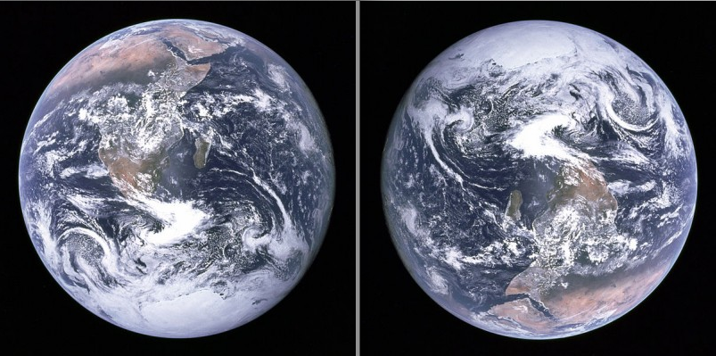
In 2004, Google acquired Keyhole, Inc., a small tech startup named in homage to the spy programme, which had built an impressive earth imagery viewer called Earth Viewer – better known today as Google Earth. Google Earth and its associated maps and guides have revolutionised how all of us see the earth, becoming accustomed to the once-privileged God’s Eye view from above. The kind of vision exalted by Hugo has become commonplace, a superpower we use to drive to the shops. But this vision has always been filtered through multiple systems and agencies.


Keyhole Inc’s earlier investors were the CIA and the National Geospatial Agency, and this proved to be a lasting marriage: in September 2008, Google’s logo was plastered on the side of a Delta II rocket which launched from Vandenberg Air Force Base in California, carrying the first GeoEye satellite, financed by the NGA. Imagery from the satellite was exclusively reserved for Google and the US government – although until last year only lower resolution images were allowed to reach the public.


This principle is known elsewhere as Selective Availability. When the Global Positioning System was developed, its stunningly and beautifully complicated mathematical underpinnings allowed for multiple signals from space-based atomic clocks to triangulate any position on the earth’s surface. But those signals are also encrypted: until 2000 (a full quarter century into the protocol’s operation) an offset introduced into the encrypted signal reduced its accuracy for non-military users, a displacement of up to a hundred metres. At global scale, this is little, but if you’re trying to build better public services through surveying or navigation, or bring a rocket-propelled grenade down on the heads of a marine emplacement, it’s pretty crippling. It wasn’t until the US military developed other systems for selectively denying GPS to specific areas that Selective Availability was turned off for everyone. You won’t be lost now – unless you make the wrong enemies.


Likewise, the ability to see from space is subject to Selective Availability. The public images from GeoEye-1 and subsequent reconnaissance satellites were restricted to a resolution of 50cm: imagine that everything around you smaller than half a metre is just a featureless rectangle. Unsurprisingly, that box neatly accommodates the human body seen from above, and I think that’s kind of beautiful, apart from the fact that much higher resolutions flowed in a constant stream to the military. The images and their spacial referents exist, but we can only see a degraded version, dislocated in time and space. The Google Earth on your desktop is a dark glass.


Incite, derail, make easy or difficult, enlarge or limit, render more or less probable: these are the categories of power. If you wanted to write about how power worked in the past, you had to do a lot of hand-waving, and you’d frequently come across as a loon. Conspiracy theories, dark hints of secret cabals, references to conferences and Portuguese golf hotels nobody else could verify. Your rants were mimeographed and stacked up in steel containers in the libraries of activist groups susceptible to fire and preemptive arrest. Now, we have Google. And I mean that both ways.


The nature of power is that it operates by a set of rules which it constantly generates, and renders obscure to the rest of us. It’s a withholding of knowledge and ability designed, quite deliberately, to remove your agency. We have the rockets and the rocketeers, the microchips and the systems engineers, the cables and the land rights, and the monopoly on force which means you can’t get near enough with your bolt-cutters and cameras.


But here’s a thing: we’re writing down those rules now. And we have, perhaps by accident or perhaps not, developed a system of universal transmission and reception which makes those rules accessible to you. Not quite yet writable, but certainly viewable. These statutes, frameworks, biases and intents, insane suppositions and logical results, are visible to us in ways that they never were before. Every image we have comes to us through systems and networks of distribution and filtration, but you can check out the codecs and routers through which they pass, whether that’s a Cisco mainframe or a right-wing nutter who’s somehow, still, fought their way to some kind of position of political responsibility. They can’t hide behind a system whose source code is readable by anyone with a net connection.


Given this understanding, what are we to do? While it’s possible for anyone to make images now, the decision to actually do so, and particularly to make images that weren’t possible before, or whose creation and mediation has been strictly limited to those with the money and the launch programme, is a radical act. So too is knowing the precedents.


Back in 1997, the Bureau of Inverse Technology flew a series of sorties over the industrial parks of Silicon Valley, using a miniature video camera strapped to a small radio-controlled plane. The plane’s view encompassed not only the offices of the well-known tech companies, but the hangars and manufacturing yards of the military-industrial complex: from Hewlett Packard to Lockheed Martin, Sun Microsystems to Moffet Air Base. All of the postwar developments of the digital industry are laid out in a view akin to Doug Engelbart’s ‘fly-through’ information space, making explicit the substrate on which contemporary culture runs. The BIT Plane is didactic, but it’s the didacticism of revolutionaries, of trespassers where instant decisions and certainty of purpose are tools of survival.


1997 was the year that the domain Google.com was registered – the company itself wasn’t legally established for another twelve months (‘disruption’). Six years later, in a field in Southern England, Simon Faithfull stakes out the ground of artistic agency in the face of Google’s orbital photographers, a year before Keyhole Inc is acquired. Attaching a small camera to a weather balloon, the aerostat takes thirty minutes to ascend from the ground plane to the edge of space, thirty kilometres from the artist’s face to the bright meniscus of the atmosphere. What seems signal about the artist’s achievement now, in a world saturated with mediated aerial imagery, is its individuality, its punk DIY attitude, its desire, above all, to see the earth on its own terms, harnessing newly available technology not merely to receive signals, but to generate them.


ABOUT THE CONTRIBUTOR

is a writer, artist and publisher based in London, UK. His work can be found at http://booktwo.org/.


Get our newsletter


* indicates required